


Remote sensing
Remote sensing in general means the detecting of information from a distance. More specifically the surface of the earth can be observed and in many cases monitored through the use of satellites or aircraft carrying specialist equipment. This equipment ranges from video and photographic equipment to laser scanning (lidar) and sensor equipment that can detect and record distances accurately as well as reflected or emitted energy.
The earliest and simplest form of remote sensing was the aerial photograph, which gave the opportunity to see for the first time large areas of land use from above, it became an important tool in recording historical landscape changes but also in planning future uses. As the resolution of images has improved along with tools enabling better interpretation and analysis, satellite imagery continues to be an important tool in governance, urban planning and architecture.
Other more specialist remote sensing tools such as radiometers measure electromagnetic energy produced by the vibration of charged particles to analyse changes in the surface and atmosphere of the earth. Spectrometers analyse the surface and atmosphere of the earth using light (either from the sun or from their own source). These passive and active sensors combined have the ability to measure land and sea surface temperature, vegetation properties, cloud and aerosol properties, physical attributes, forest structure, precipitation and wind, sea surface topography, ice among other characteristics.
Remote sensing as a core element of Geoinformatics is seen as an opportunity to better inform the field of urban planning with various free geographic information tools becoming openly available benefiting from both Geographic Information Systems (GIS) in combination with remote sensing.
The Copernicus Land Monitoring Service - Urban Atlas, developed by the European Union is one such tool, as well as the interactive UK Geoinformation tool MAgiC. Links to both tools are given below.
- https://www.eea.europa.eu/data-and-maps/data/copernicus-land-monitoring-service-urban-atlas
- https://magic.defra.gov.uk/
Whilst Google Maps and Google Earth are commonly used tools, they to some extent give access to historical aerial photographic data. Whist the Aerial Photo Explorer recently released by Historic England gives access to mapped historic aerial photographs across the UK.
- https://earth.google.com/web/
- https://historicengland.org.uk/images-books/archive/collections/aerial-photos/
NB The glossary of statistical terms, published by the Organisation for Economic Co-operation and Development (OECD), defines remote sensing as: ‘The process of acquiring information about an object from a distance; i.e. without physical contact. Remote sensing usually refers to image acquisition by means of satellite sensors or aerial photography.
[edit] Related articles on Designing Buildings
- 3D city model.
- 3D printer.
- BIM for heritage asset management.
- Building information modelling.
- Building survey.
- Construction cameras.
- Construction drones.
- Desk study.
- Development appraisal.
- Drones as a Service DaaS.
- Geophysical survey.
- Global positioning systems and global navigation satellite systems.
- Ground control point GCP.
- How can drones transform construction processes?
- How to layout a building.
- Impulse radar.
- Innovation and investigation at the Hill House.
- Interview with David Southam about laser scanning in construction.
- Laser.
- Laser scanning for building design and construction
- Pre-construction information.
- Radar.
- Site information.
- Site surveys.
- Surveying instruments.
- Surveyor.
- Technical due diligence.
- Uses of drones in construction.
- Vendor survey.
Featured articles and news

Gregor Harvie argues that AI is state-sanctioned theft of IP.

Many resources for visitors aswell as new features for members.
Using technology to empower communities

The Community data platform; capturing the DNA of a place and fostering participation, for better design.
Heat pump and wind turbine sound calculations for PDRs
MCS publish updated sound calculation standards for permitted development installations.
Homes England creates largest housing-led site in the North

Successful, 34 hectare land acquisition with the residential allocation now completed.
Scottish apprenticeship training proposals

General support although better accountability and transparency is sought.
The history of building regulations

A story of belated action in response to crisis.
Moisture, fire safety and emerging trends in living walls

How wet is your wall?

Current policy explained and newly published consultation by the UK and Welsh Governments.

British architecture 1919–39. Book review.

Conservation of listed prefabs in Moseley.

Energy industry calls for urgent reform.
Heritage staff wellbeing at work survey.

A five minute introduction.
50th Golden anniversary ECA Edmundson apprentice award
![]()
Showcasing the very best electrotechnical and engineering services for half a century.
Welsh government consults on HRBs and reg changes
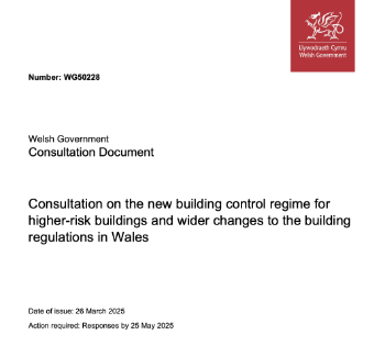
Seeking feedback on a new regulatory regime and a broad range of issues.
CIOB Client Guide (2nd edition) March 2025

Free download covering statutory dutyholder roles under the Building Safety Act and much more.